
Company Overview
Avino Silver & Gold Mines Ltd. is a precious- and base-metal mining company with a long operating history in Mexico. Its main assets are located in the state of Durango, within a well-established epithermal silver–copper–gold district.
The company’s operations include the producing Avino Mine, where mineralization is dominated by copper and silver with associated gold, as well as the nearby La Preciosa Project, a silver-dominant development asset that also contains gold. Together, these assets give Avino a producing base with established infrastructure and significant exploration upside.

This use case describes how Avino applied DORA, VRIFY’s AI prospectivity mapping software, to support exploration planning from near-mine areas through to the district scale.
The Why
The district hosts numerous mineralized epithermal veins and breccias that are locally well-expressed at surface. These outcrops have historically guided exploration through conventional mapping and sampling, supporting resource development across the area.
However, prospective ground is not evenly exposed. Large parts of the district are covered by post-mineral material, including valley fill and younger volcanic units, which can mask potentially fertile bedrock. These covered areas are more difficult to evaluate using surface-based methods, yet they represent an important source of potential future resource growth.
In addition, Avino controls an extensive land package around its operating and development assets, supported by decades of historical exploration. Evaluating this broader area in a consistent manner, particularly where geological exposure is limited, requires an approach that can integrate multiple datasets and apply the same logic across the entire district.
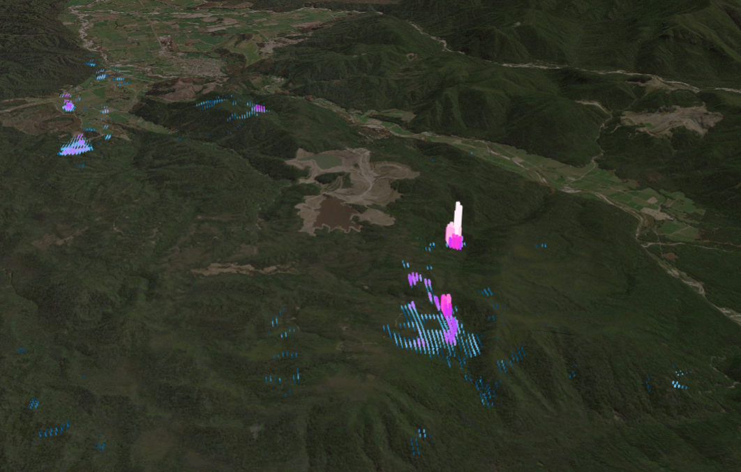
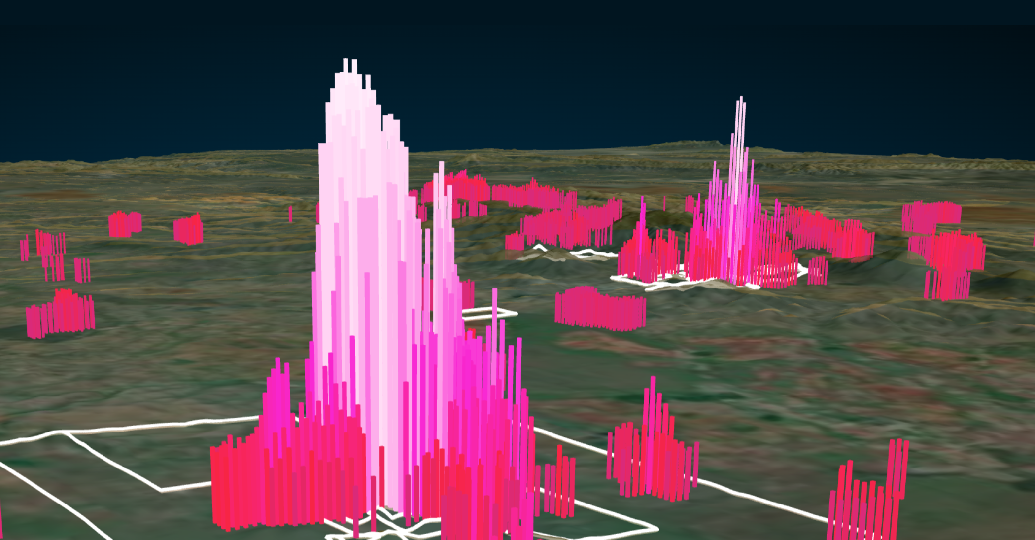
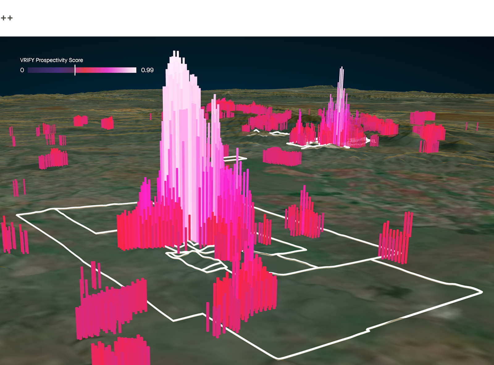
DORA was applied to meet this need. It enabled Avino to integrate a wealth of data, historical and recent, to assess prospectivity in both exposed and covered settings using a consistent, objective framework at multiple scales.
The Process
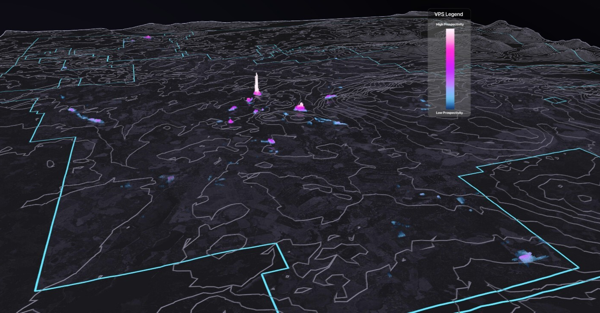
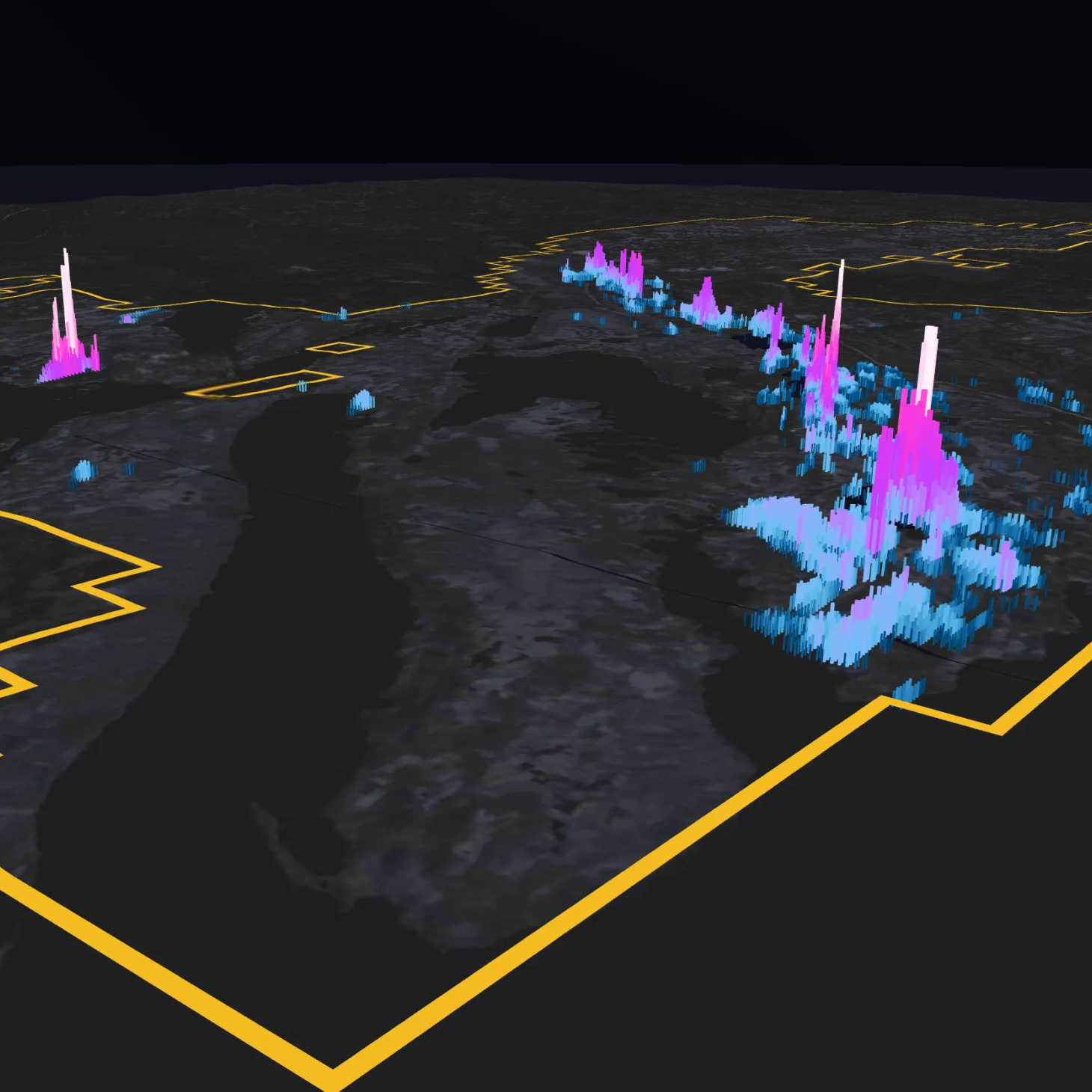
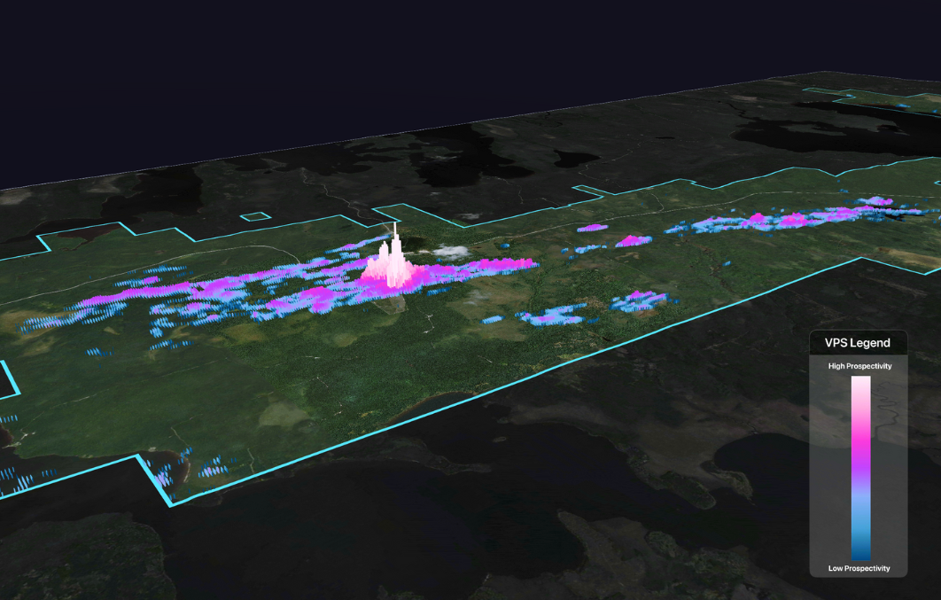
Avino’s work with DORA began at the scale of the full claim block, covering both the Avino Mine and La Preciosa Project. Where data density permitted, this property-wide assessment was complemented by higher-resolution modelling focused on individual assets.
A key part of the workflow involved assembling and validating available datasets. The VRIFY team worked closely with Avino to compile historical and modern datasets from both proprietary and public sources into a coherent dataset, resolving inconsistencies and addressing data gaps. During this process, additional legacy geophysical data was identified and recovered, including airborne electromagnetic data from Z-axis tipper electromagnetic (ZTEM) surveys that had not been part of Avino’s active dataset. Incorporating this data expanded geophysical coverage in key areas of the district and strengthened the overall analysis.
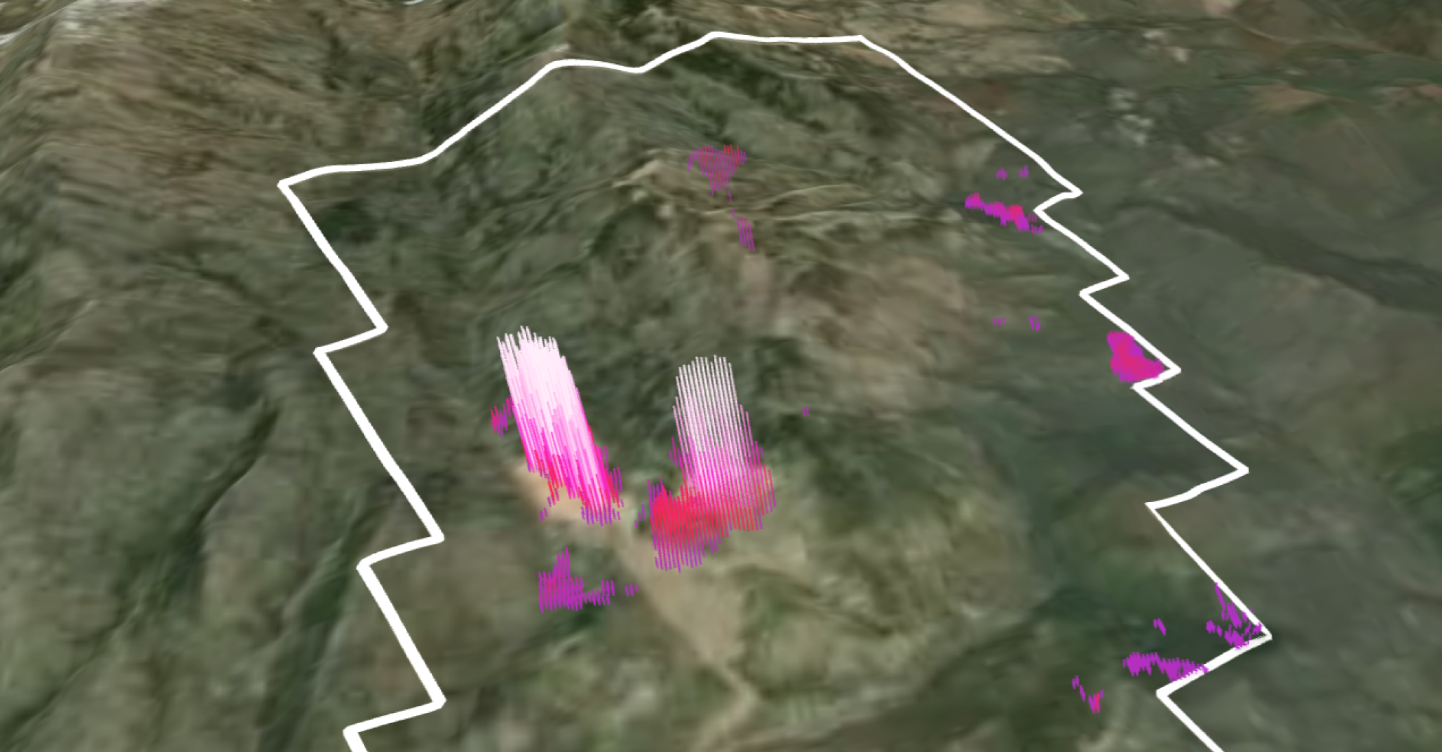
Prospectivity modelling relied mainly on airborne magnetic data and ZTEM-derived electrical products, with gravity and geochemical data included where appropriate. Surface datasets, including topography and remote-sensing products, provided additional geological context. Because mineralization in the district is strongly structurally controlled, lineaments extracted using the Lineament Maps Module within DORA’s Data Augmentation suite played a central role in the analysis. Computer-vision and texture-filter outputs from DORA further improved structural interpretation and helped refine targets.
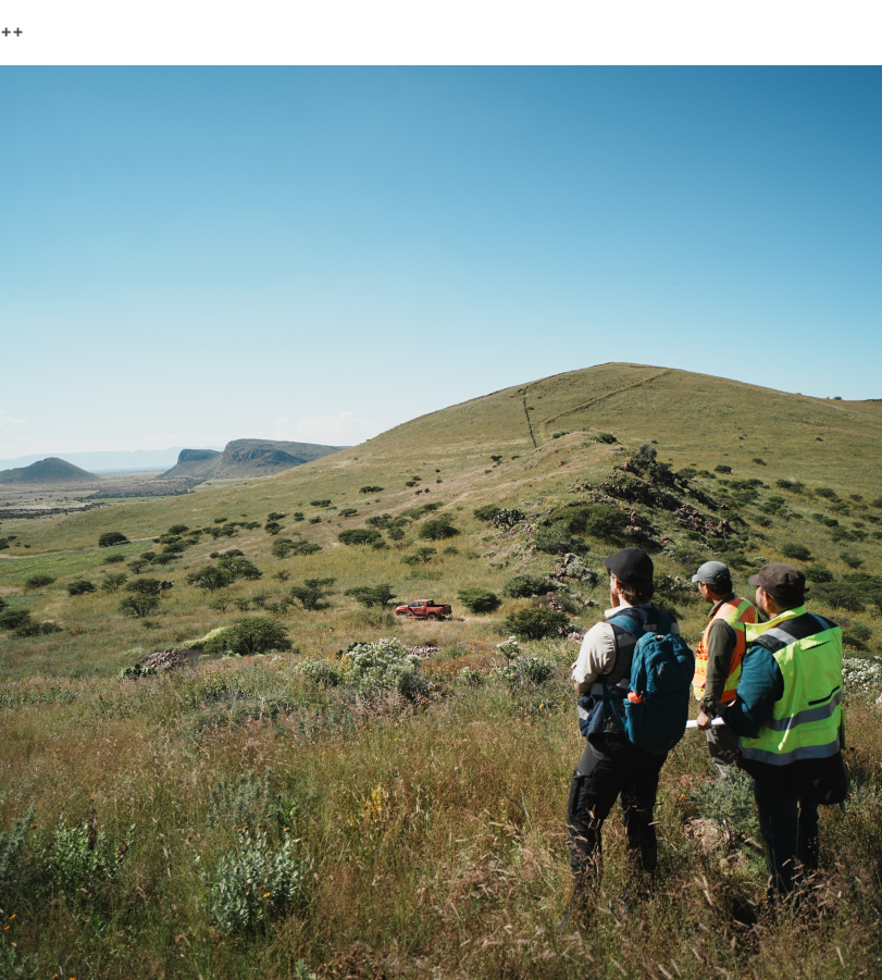
The engagement also included on-site collaboration. The VRIFY team worked directly with Avino’s site geologists to review modelling results in the field and discuss how DORA outputs could be used within existing exploration workflows. Observations from the site visit guided later modelling iterations, allowing the analysis to evolve alongside field-based geological understanding.
The Outcome
Getting DORA in the hands of Avino’s experienced geologists has helped them move faster and gain a better understanding of their data. The software provided a clear, property-wide view of the mineral potential, through the VRIFY Prospectivity Score, and a structured way to evaluate both near-mine and broader district opportunities. Modelling results were used to generate and rank exploration targets within the land position, supporting prioritization and more focused follow-up work.
Exploration is ongoing, but the DORA workflow has already enabled more consistent decision-making in areas affected by cover. It has also established a repeatable framework for planning ground validation and drilling. As new data is added, DORA continues to be used to test geological hypotheses and refine targeting across the district-scale mineral system.
"By using VRIFY’s DORA software, we have been able to quickly assess prospectivity across both exposed and covered parts of the district by integrating geophysical, geological, and geochemical datasets within a single, objective framework. This is critical for evaluating concealed areas that are difficult to assess using surface-based methods alone, while allowing us to more efficiently generate and prioritize exploration targets."
Peter Latta, VP Technical Services, Avino Silver & Gold Mines Ltd.
<hr />
To learn more about DORA and VRIFY’s broader suite of tools for exploration analysis and effective communication with stakeholders, book a demo with our Geoscience Team.