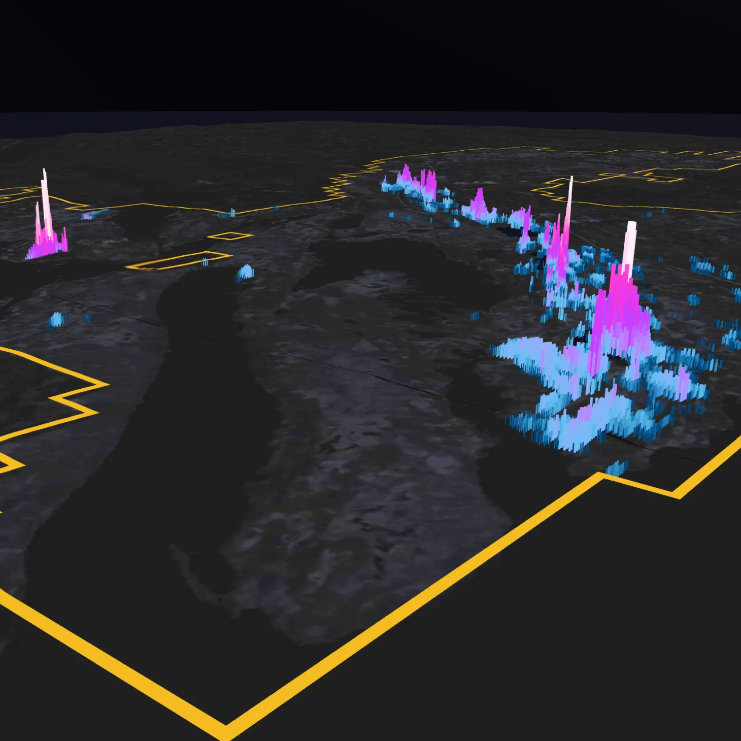

The next discovery doesn't always require new data. Sometimes, it requires a new way of looking at what already exists.
For Legacy Minerals, with a portfolio of nine projects spanning more than 2,450 square kilometres across New South Wales' prospective Lachlan and New England Fold Belts including flagship assets Mt Carrington, Bauloora, and Fontenoy, the opportunity to uncover new insights from existing exploration data was significant.
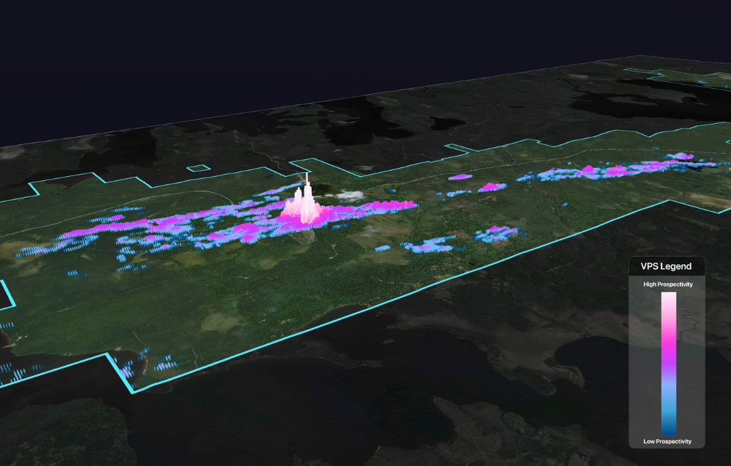
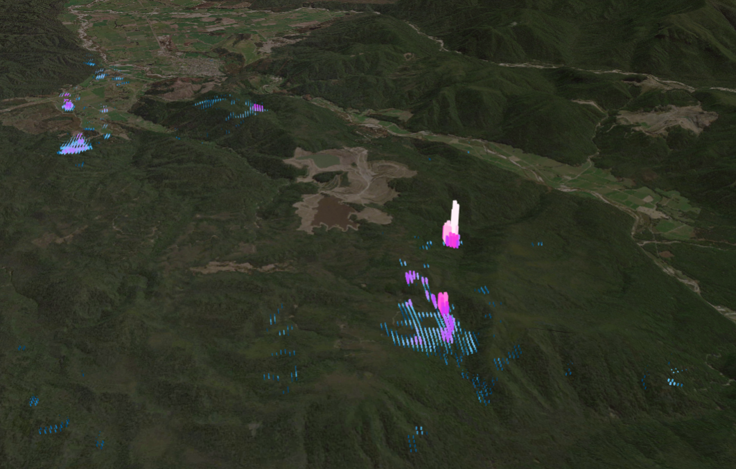
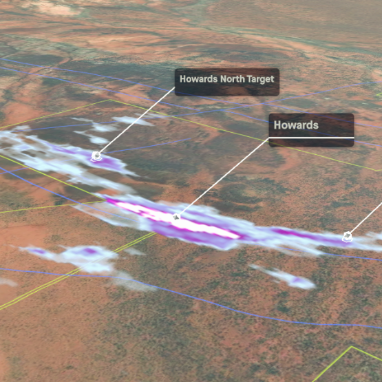
At its flagship Mt Carrington gold-silver-copper project, the Legacy Minerals team looked to systematically evaluate exploration potential across this land position and identify new opportunities for potential discovery. To support this work, the team applied VRIFY's AI prospectivity mapping software, DORA, to a district-scale epithermal system, combining existing exploration data and geoscientific expertise with AI to generate prospectivity maps and identify potential exploration targets.
Background Geology
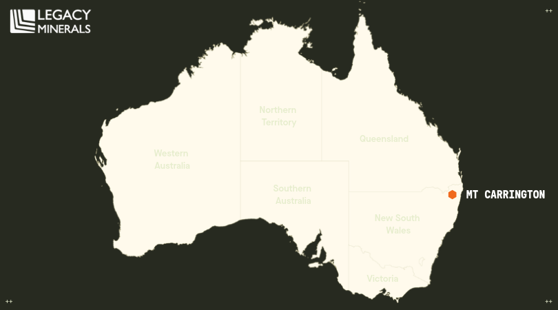
The Mt Carrington Project is a district-scale epithermal gold-silver-copper system located in northern New South Wales, approximately 170 kilometres south-southwest of Brisbane. Situated within the southern New England Orogen1, the project is centred on the Late Permian Drake Volcanics, a thick bimodal volcano-sedimentary sequence with numerous contemporaneous andesite-to-rhyolite sub-volcanic stocks and dykes2 extending across approximately 700 square kilometres within a north-northwest-trending continental rift corridor3.
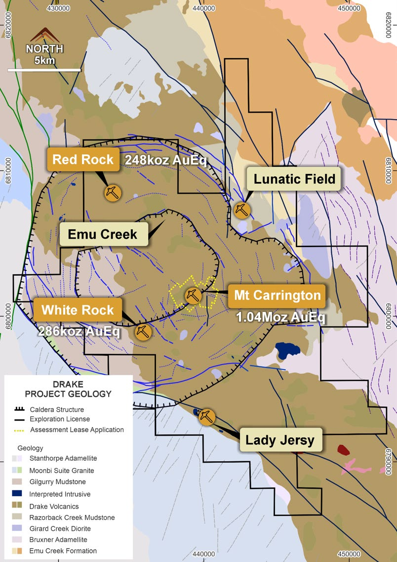
Much of the district's mineralization occurs within a large, circular caldera complex, first identified through a 20-kilometre-wide, low-magnetic-relief anomaly known as the "Drake Quiet Zone." This zone is a low-magnetic-relief anomaly in CRA Exploration’s aeromagnetic data2 (figure 2). Further, the caldera is interpreted as a collapsed volcanic centre that hosted resurgent, andesitic-to-felsic magmatic activity late in its geological history.
Gold and silver deposits at Mt Carrington are primarily interpreted as low- to intermediate-sulphidation epithermal vein-style mineralization4, expressed across three broad physical styles:
- Discordant fault-vein “fissure” lodes generally greater than or equal to one metre thick with classic colloform and crustiform banding, typified at Mt Carrington itself
- Stratabound stockworks, typified at Strauss, North Kylo and Guy Bell, and;
- Stratabound disseminations typified at Lady Hampden5
Mineralization is further associated with extensive phyllic to silicic (silica-sericite) alteration and is localized along the margins of andesite-to-rhyolite domes, plugs, and lava flows within a sequence dominated by andesitic volcaniclastics1.
At the district scale, metal zonation is evident: a gold-rich, base metal–associated (Zn-Cu-Pb) core (Strauss/Kylo/Guy Bell) grading outwardly into silver-dominant peripheral systems (White Rock/White Rock North/Silver King/Lady Hampden), with local copper-gold enrichment at structural margins (White Rock's SW zone)6,7. Though silver-rich at deposit scale, Lady Hampden is isotopically grouped with the intermediate sulfidation state base-metal-associated clusters of mineralized centers at Mt Carrington8.
The Why
With extensive exploration datasets and deep geological knowledge of the Mt Carrington district, Legacy Minerals saw an opportunity to explore how AI could complement its team's expertise and support a more systematic approach to evaluating exploration potential.
The team turned to VRIFY's AI prospectivity mapping software, DORA, to generate and rank exploration targets across the district. The objective was to identify and prioritize near-term drilling opportunities, from brownfields extensions surrounding its existing 115 Moz AgEq Mineral Resource9, to regional greenfields targets beyond known mineralisation.
Rather than replace geological judgement, Legacy Minerals wanted to understand how AI could enhance its existing exploration workflows, uncover new insights from its data, and support more efficient and data-backed decision-making. From the outset, the team approached targets generated through DORA as opportunities for further investigation, recognizing that each would require geological validation and, where warranted, drill testing before being considered a confirmed prospect.
The Process
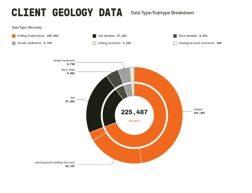
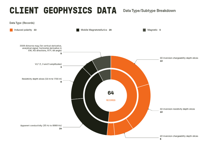
The prospectivity models developed using DORA drew on decades of exploration data collected by companies operating in the area, including Carpentaria Exploration, Newmont, Aberfoyle Exploration, Mount Carrington Mines, CRA Exploration, White Rock Minerals, and Legacy Minerals (Figures 2 and 3). Historical drilling and rock-chips were used as learning points for the AI models, ultimately underpinning the resulting prospectivity models.
Below is an overview data used in the process:
Regional Scale Inputs
- Regional and 2009 magnetic surveys and their derived layers (analytic signal, tilt, lineament products)
- Regional gravity, including isostatic residual and tilt products
- Airborne radiometrics
- Mobile Magnetotellurics (MMT) resistivity inversion and MMT apparent conductivity anomaly grids
- LIDAR-derived structural lineaments and mapped bedding strikefield
- Geological point and line vector data
- Soil samples (mostly aqua regia, subset of ionic leach)
- Drill rock samples
- Surface rock samples
Mt Carrington Deposit Scale Inputs
- 3D IP (Induced Polarization) resistivity inversion
- MMT resistivity inversion and MMT apparent conductivity anomaly grids
- 2009 magnetic survey and derived layers
- Gradient IP
- Geological maps
Data Augmentation
Before modelling starts, VRIFY’s data augmentation software, Explore, integrates the raw regional data with proprietary datasets into a single, fully aligned data stack. At Mt Carrington, this process surfaced new patterns and produced consistent, analysis-ready layers from datasets that had not previously been reconciled holistically. Within the Explore software, specific data augmentation modules were used to prepare the exploration data sets for modelling in DORA by rasterizing vector data and enhancing signals present in source rasters. One hundred and thirty new layers were generated through this process with the goal of broadening the analytical context. Examples of outputs via Explore’s data augmentation:
- Distance from mapped high-amplitude magnetic-roughness domains — a proxy for intrusive/alteration-related magnetic complexity
- Distance from key units and interpreted structures
- Computer vision filters applied to geophysical surveys
- Lineament analysis derived from 2009 magnetic survey
- Anisotropy strike field maps of bedding and vein orientations
- Soil geochemistry grids, and derived multivariate anomaly maps
Modelling Strategy
Prospectivity models were run at two spatial scales:
- A Property/Regional Area of Interest (AOI) scale — this covered the full 393km² licence package
- Smaller AOIs focused on the Mt Carrington deposit cluster covering the immediate caldera and at White Rock
DORA combined Legacy Minerals' project-specific drilling, geochemistry, geophysics, and structural information with VRIFY's global reference datasets, then applied machine-learning pattern recognition across the full data stack created during the data augmentation process referenced above. For this project, a pre-trained epithermal systems specific Foundation Model in DORA was used. These Foundation Models are conceptually similar to a large language model (LLM), but are instead focused on rasterized geoscience inputs, enabling the evaluation of thousands of geological scenarios and the recognition of spatial relationships that are difficult to resolve through conventional interpretation alone.
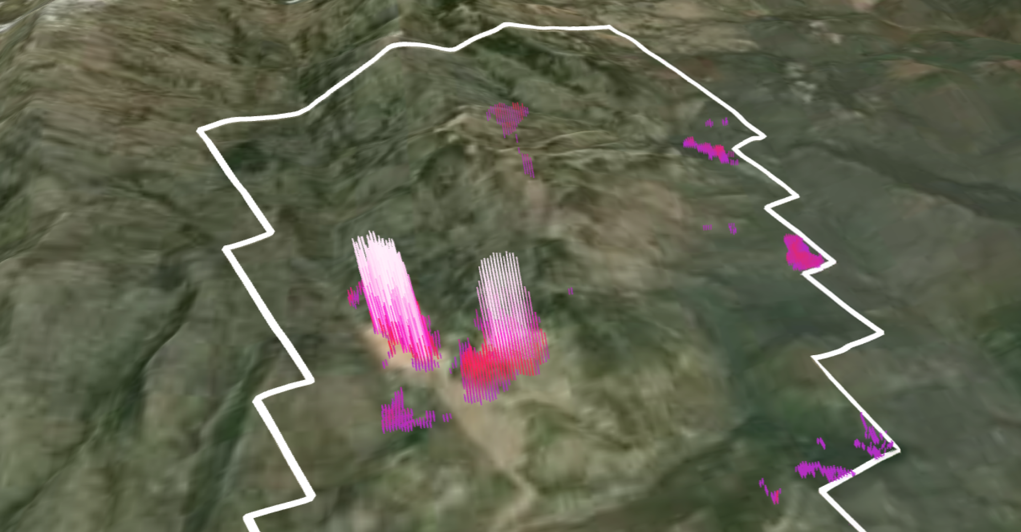
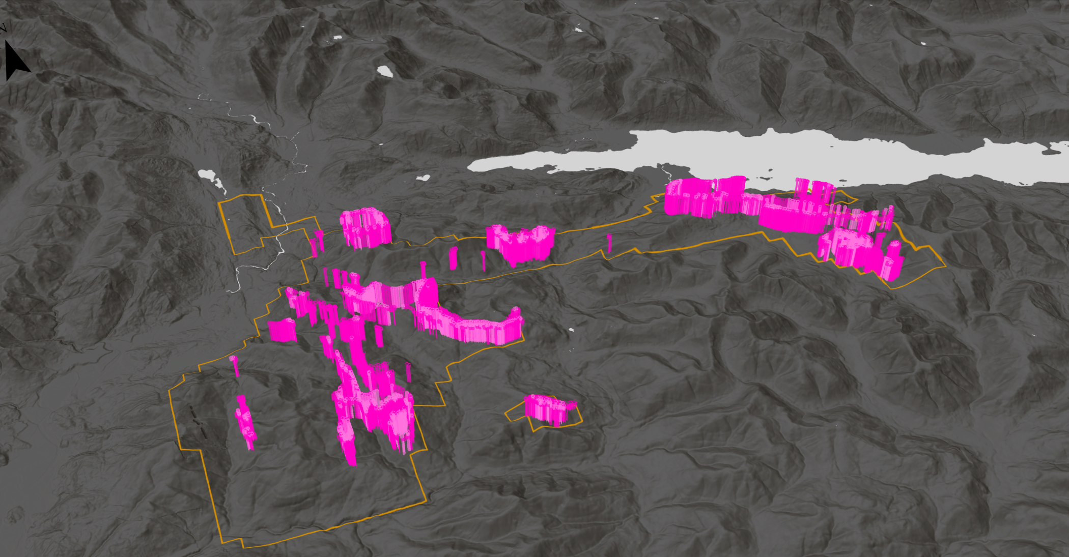
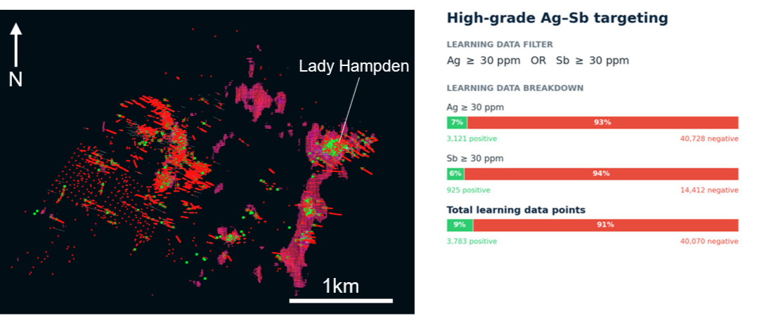
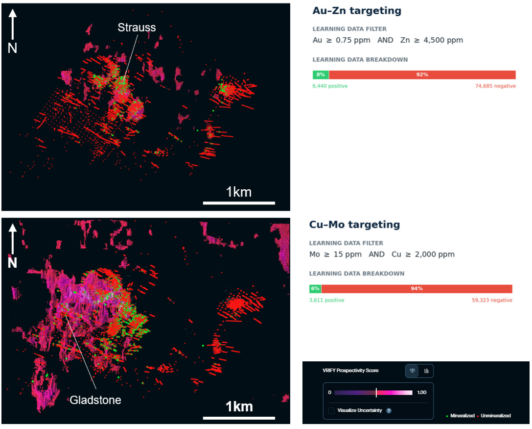
At the Mt Carrington cluster (Figure 2, yellow AOI), the Legacy Minerals team tested whether the district's known metal zonation could be recovered directly from the data and if new assemblage-specific targets could be generated. Three geochemical assemblages were mapped against the same learning-point dataset and returned three distinct, spatially separated domains (Figure 4):
- A western, copper-molybdenum (+/- bismuth) domain associated with intrusive centres
- A central, gold-dominant epithermal domain closely associated with zinc
- An eastern, silver-dominant epithermal domain characterized by antimony, tellurium, mercury, lead, and zinc
The pattern is consistent with a single genetic system for the Mt Carrington cluster, exhibiting higher temperature mineralization at Gladstone in the west, with temperature decreasing eastwards to lower temperature mineralization at Lady Hampden. This zonation test both validated the geological model and helped select the pathfinder-element combinations used in the final targeting models below.
The Outcome
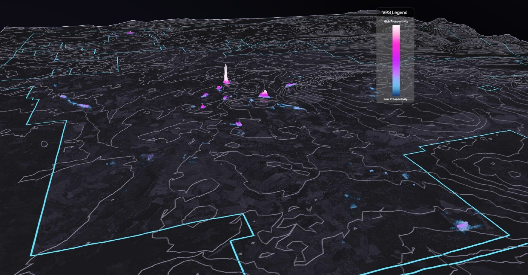
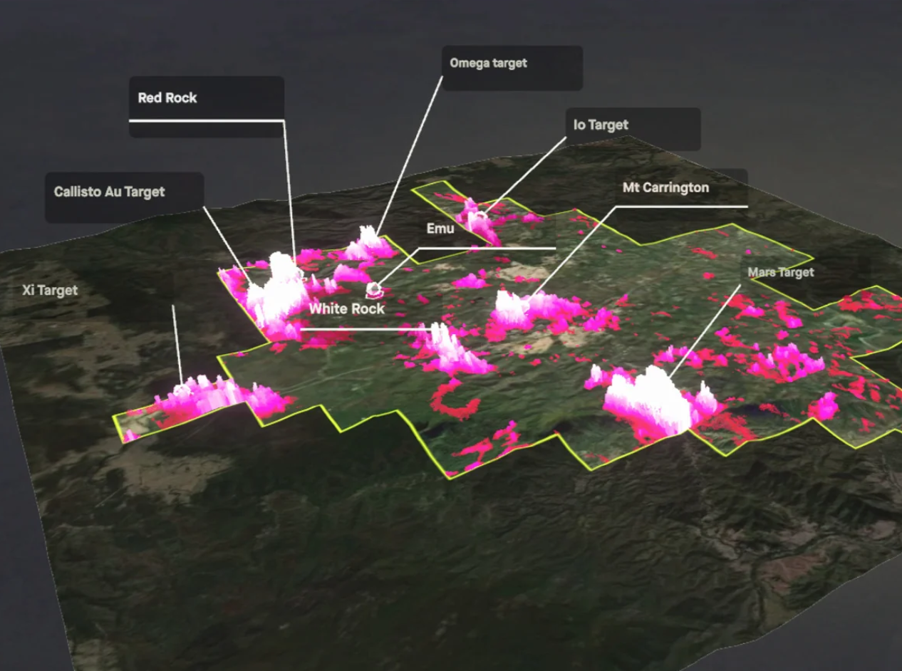
The collaboration between Legacy Minerals and DORA resulted in 18 prospectivity models being built and iterated upon across the two spatial scales (Regional and Mt Carrington). The modelling identified 38 targets with strong prospectivity scores, confirmed several previously recognized areas of interest, including Emu, Battery and Mascotte, and generated new, ranked targets across the broader Mt Carrington Project.

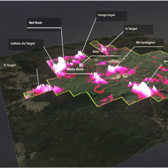
Beyond the existing resource footprint, Legacy Mineral’s study using DORA defined new regional target clusters (Omega, Zi, Mars and Callisto) that are semi-coincident with previously recognized prospective areas such as Battery, Emu, and Mascotte, thus expanding the project's discovery pipeline (Figure 5 ).
At the deposit scale, six Mt Carrington models were run and refined, including dedicated gold-zinc, silver-antimony, and copper-molybdenum pathfinder models. Further, a variant of the copper-molybdenum model was re-run using only learning points below 400 metres of elevation. This was done specifically to test whether the model could “see deeper” toward a possible porphyry source.
Feature-importance rankings helped the team understand which data inputs had the greatest influence on each model’s predictions, allowing them to critically evaluate the results rather than relying on prospectivity maps alone. Mobile MT resistivity and conductivity at depth was the single most important input across all three finalized property-scale models, followed by magnetics, gravity and structural lineament layers (Figure 6). This provided direct model-level support for Legacy Minerals' broader interpretation that deep-seated conductive feeder structures are a first-order control on the system. In the smaller AOI covering the Mt Carrington cluster the local 3D IP inversion was an important predictor (Figure 6).

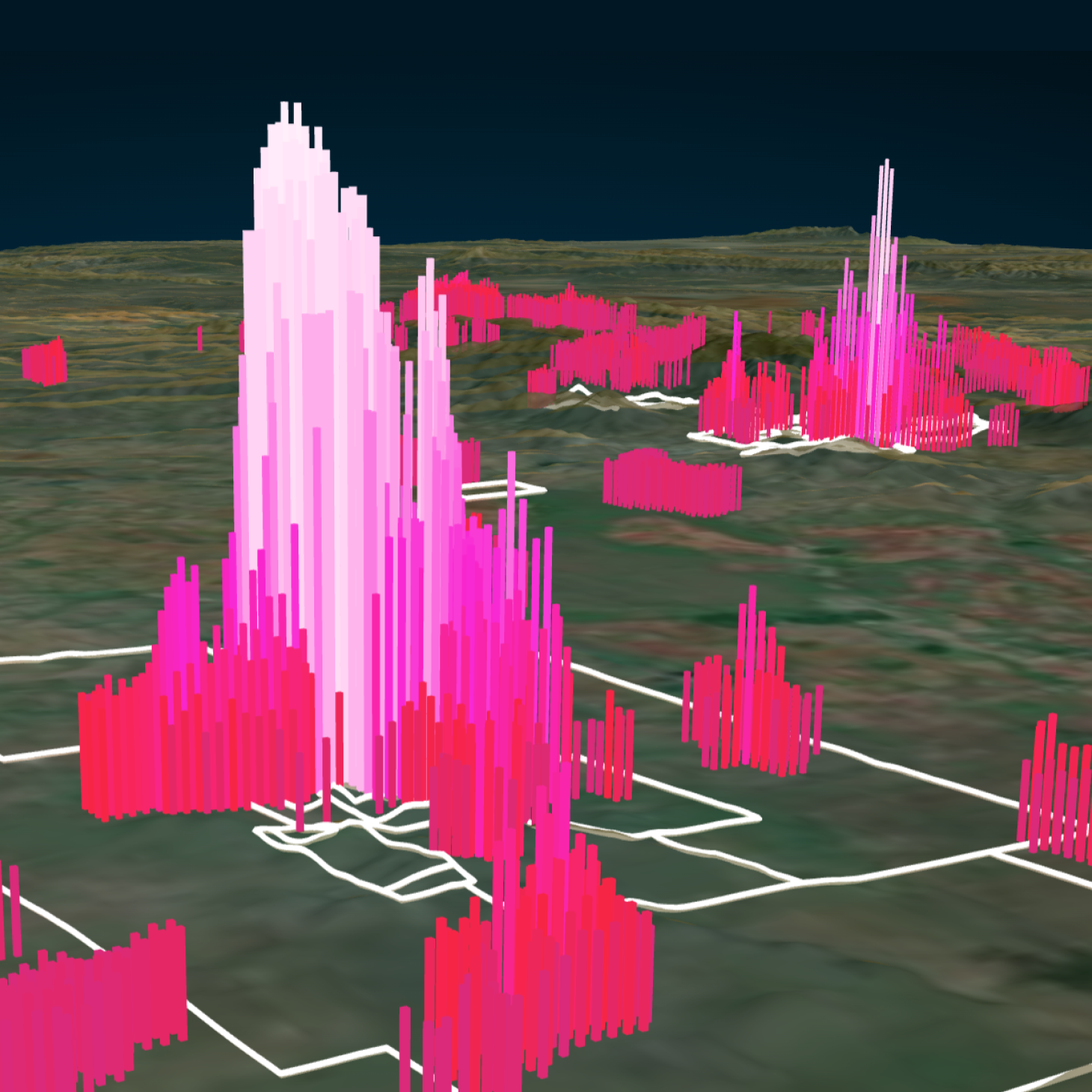
Ultimately, this use case highlighted extensional targets near known mineralization at Mt Carrington and White Rock, interpreted to be open along strike and at depth. These findings identified opportunities for follow-up exploration aimed at expanding resources in both the silver- and gold-dominant parts of the system. At White Rock, new targets named Lambda, Nu, Gamma, and Link were defined as compelling brownfields drill targets around the existing White Rock (12.9Moz AgEq) and White Rock North (5.4Moz AgEq) deposits.
Collectively, the results reinforce Mt Carrington's position as a district-scale, epithermal gold-silver-copper opportunity with multiple avenues for value creation: brownfields resource growth around ten already-defined deposits and regional discovery across a project area that remains underexplored relative to its geological scale and endowment.
For Legacy Minerals, applying DORA resulted in a prioritized pipeline of exploration targets, supported by model diagnostics alongside geological interpretation. This data-driven approach provides a stronger foundation for planning exploration programs and allocating resources efficiently, moving beyond traditional deposit-by-deposit assessments.
What the application application of VRIFY’s AI technology has done is bring the Mt Carrington exploration dataset together in a disciplined way to help us rank where the next phase of value may emerge, both around known deposits and in areas that have seen limited effective follow-up.
Chris Byrne, CEO & Managing Director of Legacy Minerals
Discover what’s possible with your exploration data: https://vrify.com/ai-demo
<hr />
Sources
1Houston, M.J., 1993. The geology and mineralisation of the Drake mine area, northern NSW, Australia. In: Flood, P.G. & Aitchison, J.C. (eds), New England Orogen, eastern Australia. Proceedings of the NEO ‘93 Conference, Armidale, 2–4 February 1993. Department of Geology and Geophysics, University of New England, Armidale, pp. 337–348.
2Esterio, H., 2003. Distribution and chemical speciation of metals in waters and sediments impacted by acid mine drainage in the Drake mining area, NSW, Australia. PhD thesis, School of Environmental Science and Management, Southern Cross University. https://researchportal.scu.edu.au/esploro/outputs/doctoral/Distribution-and-chemical-speciation-of-metals/991013321028702368
3Quan, H., 2022. The genesis and evolution of the Drake Goldfield, north-eastern New South Wales, Australia. PhD thesis, University of New South Wales, Sydney.
4Madayag, E., Graham, I., Quan, H., Worland, R., Adler, L. & Dietz, C., 2021. Mineralization, alteration assemblages and stable isotopes of the intermediate-sulfidation epithermal Strauss deposit, Drake Goldfield, north-eastern NSW, Australia. Environmental Sciences Proceedings 6, 27. https://doi.org/10.3390/iecms2021-09350
5Offenberg, A.C. & Cochrane, G.W., 1975. Drake mineral field. In: Knight, C.L. (ed.), Economic Geology of Australia and Papua New Guinea, 1. Metals. Australasian Institute of Mining and Metallurgy, Monograph 5, Melbourne, pp. 721–724.
6Beeson, B. & Borton, D., 2006. The Mt Carrington epithermal gold-silver-zinc system and the host Drake Volcanics. Extended abstract, Mines & Wines 2006: Mineral Exploration in New South Wales, 25–26 May 2006. Sydney Mineral Exploration Discussion Group (SMEDG) and NSW DPI Geological Survey. https://smedg.org.au/wp-content/uploads/2015/05/Beesab.pdf
7Corbett, G., 2011. Comments on recent exploration in the Mt Carrington region, eastern Australia. Internal report prepared for White Rock Ltd, Corbett Geological Services Pty Ltd, Willoughby, NSW, September 2011, 33 p.
8Quan, H., Graham, I., Worland, R., Adler, L., Dietz, C., Madayag, E., Wang, H. & French, D., 2025. Interpreting the complexity of sulfur, carbon, and oxygen isotopes from sulfides and carbonates in a precious metal epithermal field: insights from the Permian Drake epithermal Au-Ag field of northern New South Wales, Australia. Minerals 15(2), 134. https://doi.org/10.3390/min15020134
9News release: Artificial Intelligence Highlights Untested Potential at Mt Carrington