Company Overview
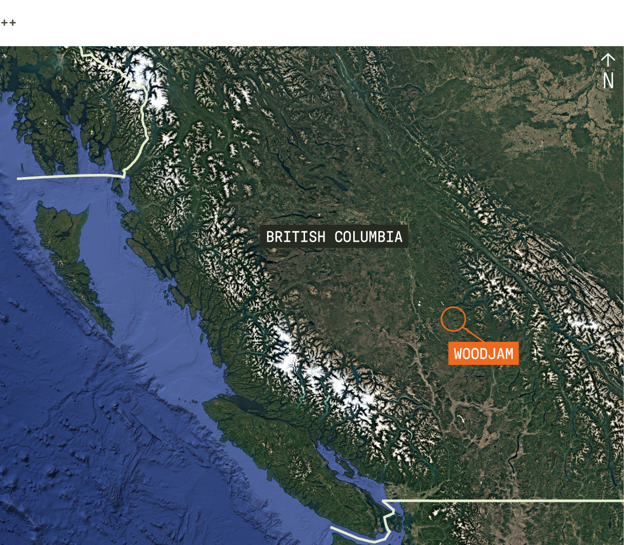
Vizsla Copper is a mineral exploration company focused on copper and gold, with additional exposure to metals such as molybdenum, in British Columbia, Canada. Its principal assets include the Woodjam and Poplar properties, both covering large, contiguous land packages.
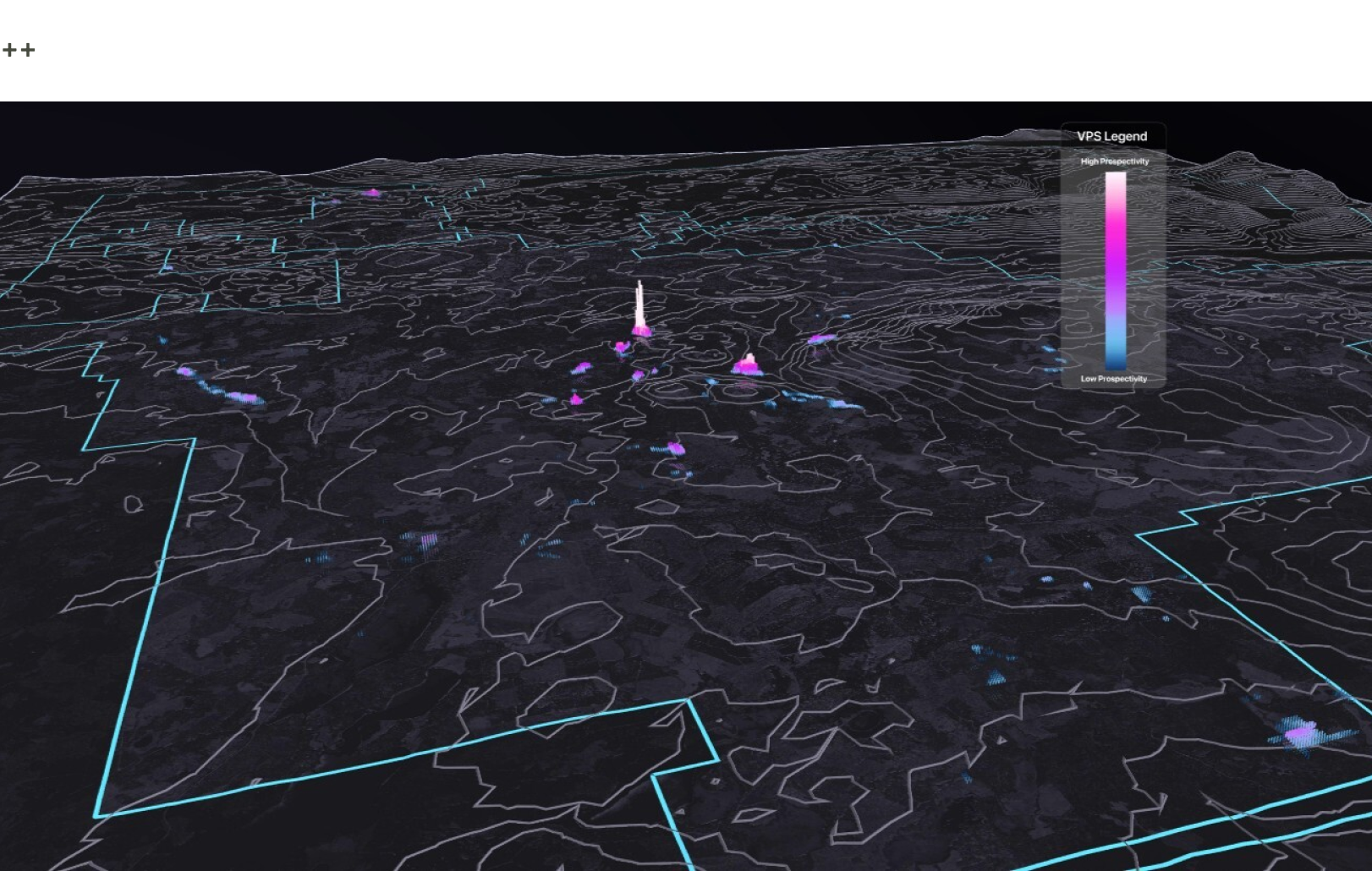
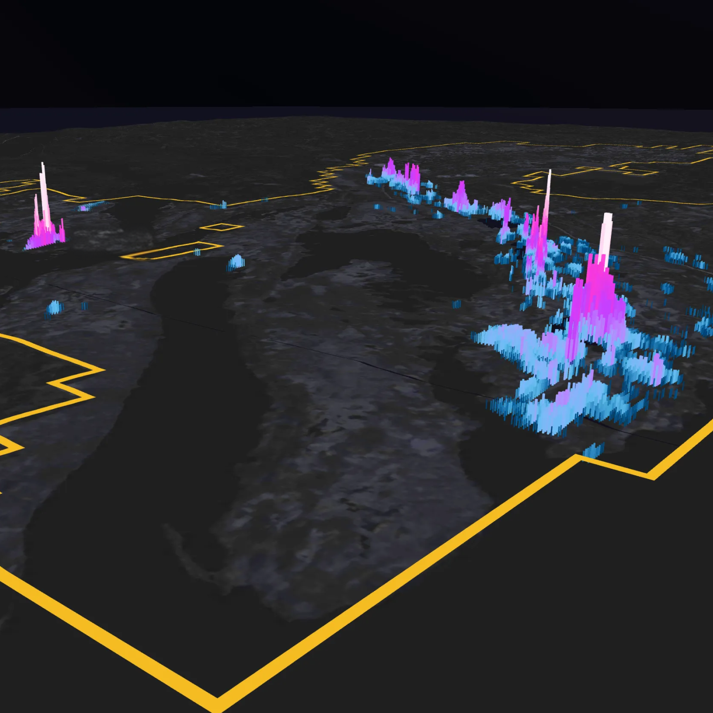
This use case highlights Vizsla Copper’s application of DORA, VRIFY’s AI prospectivity mapping software, at the Woodjam Project, a copper–gold porphyry exploration property located within the Quesnel Terrane of south-central British Columbia.
The Why
Woodjam is a mature copper district with a long history of exploration that includes extensive geophysical surveys and drilling. Several porphyry copper-gold and copper-molybdenum centres have already been identified across the property, confirming its strong mineral potential.
Despite broad exploration activity, evaluation at the property scale has remained uneven, largely due to the significant presence of cover. Younger post-mineral rocks and widespread glacial sediments limit direct geological exposure and reduce the effectiveness of traditional surface-based exploration methods. As a result, areas away from known deposits have received less systematic testing, making it difficult to evaluate the district as a whole using a consistent, property-wide approach.
These challenges led Vizsla Copper to use DORA to take a fresh look at Woodjam. The goal was to identify prospective areas that may have been overlooked due to cover or incomplete induced polarization (IP) survey coverage.
The Process
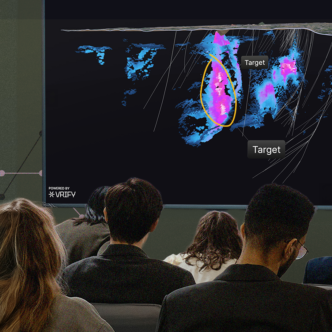
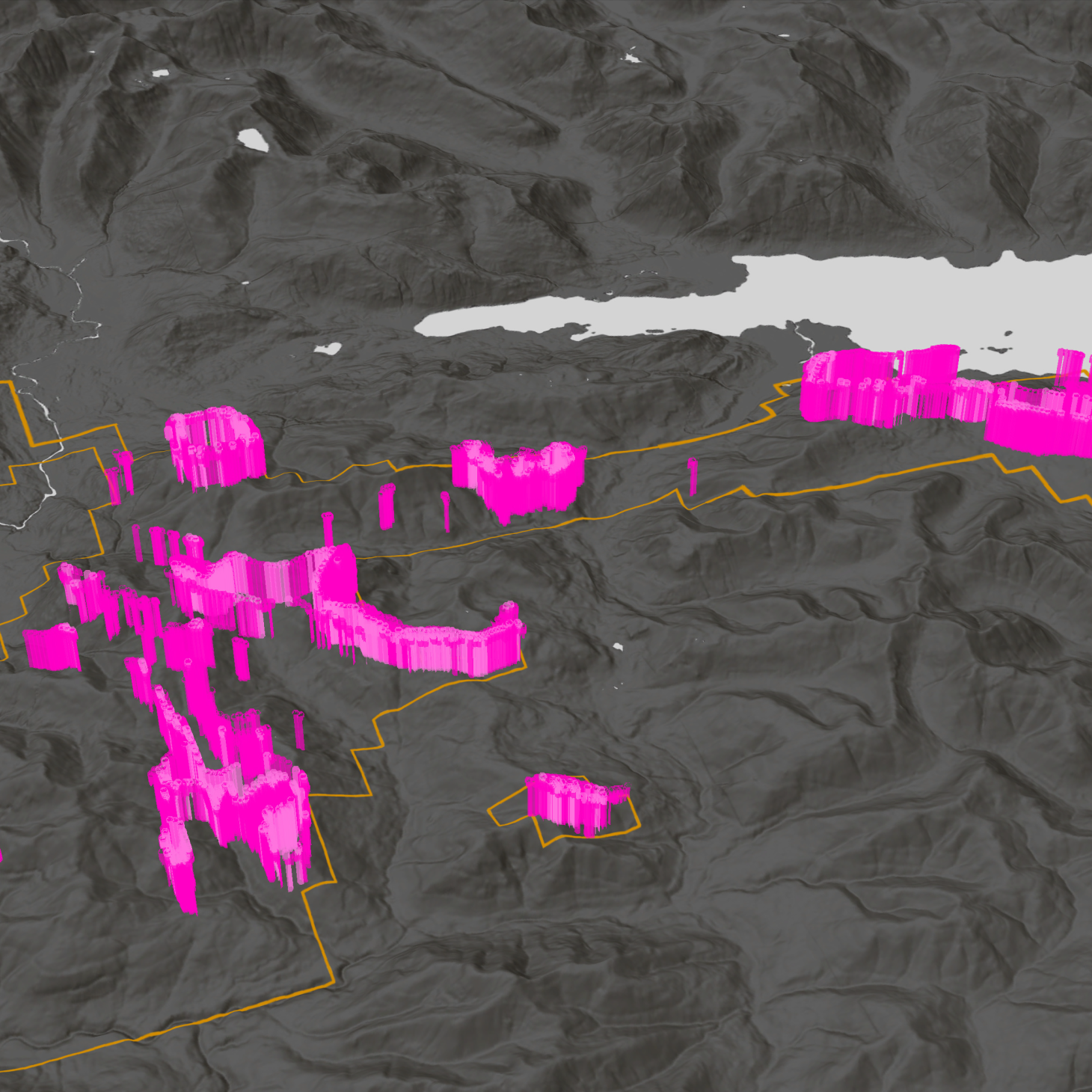
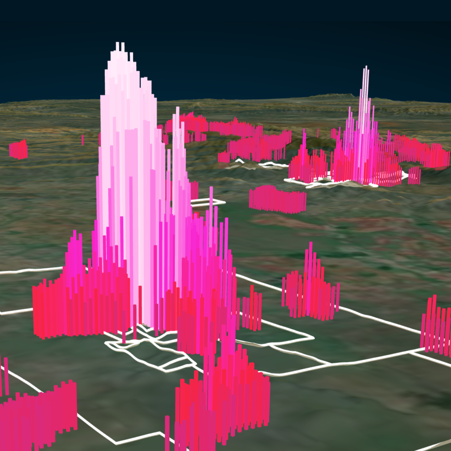
Vizsla Copper and VRIFY’s work at Woodjam focused on understanding the structural controls on the magmatic–hydrothermal centres and how they are expressed across multiple property-specific and regional geophysical datasets. Visible in several geological and geophysical datasets, the dominant structural grain of the Quesnel arc in the Woodjam region trends northwest. At the property scale, however, Nicola units and some mineralized centres trend northeast, at an angle to the dominant fabric in this region.
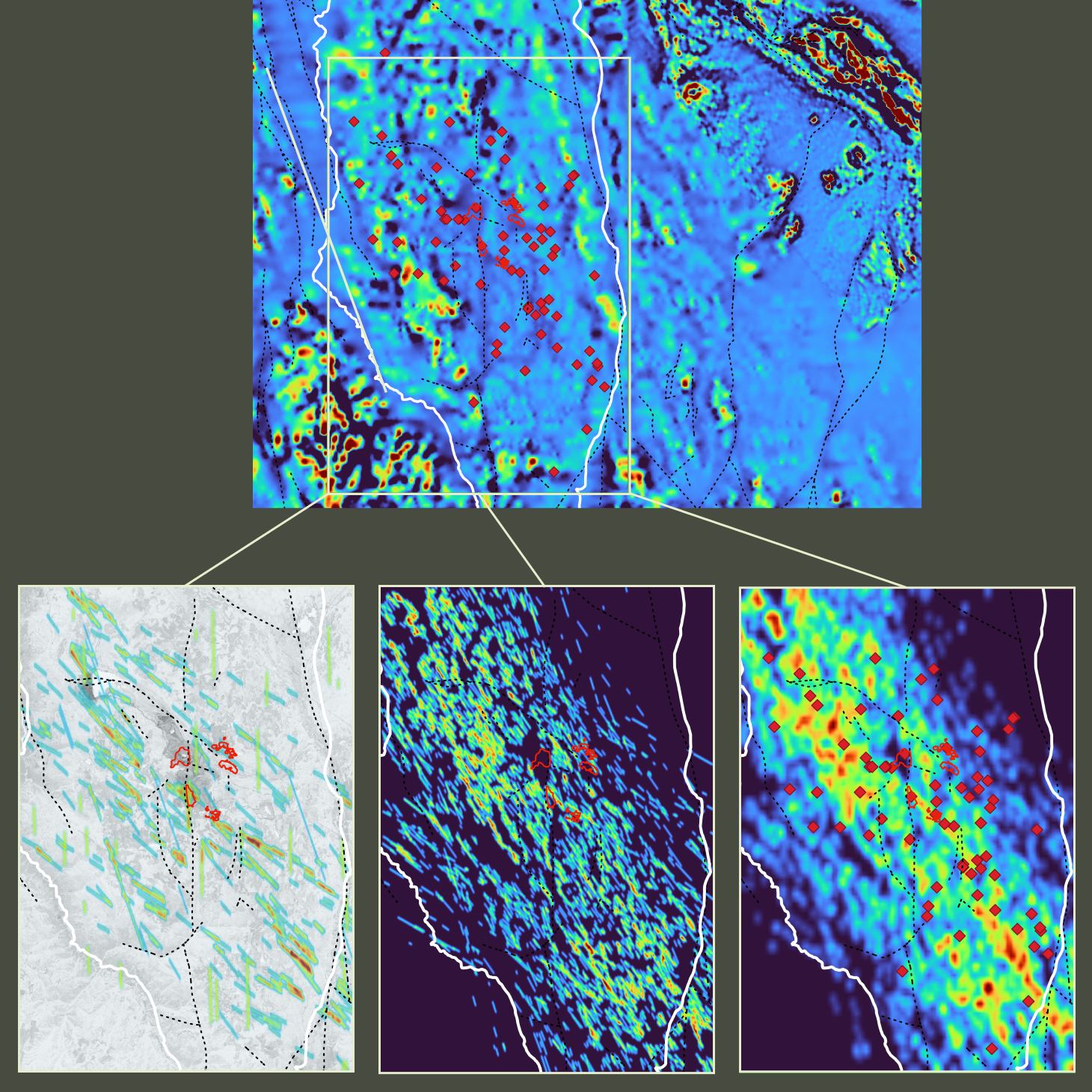
Magnetic lineaments, extracted using the Lineament Maps Module within DORA’s Data Augmentation suite, were used as proxies for structures controlling the distribution of stocks and mineralization. These lineaments extend under areas of post-mineral cover. Till geochemistry predictive maps were also generated and included in some of the property-wide prospectivity models. In addition, prospectivity models were run on a smaller area of interest to incorporate available 3D IP data.
Using DORA’s Foundation Models, which support target refinement and hypothesis testing, five primary input data types with consistent property-wide coverage were integrated. These included regional magnetics, local airborne magnetics, gravity inversion products, till geochemistry, and structural lineaments. Results from multiple prospectivity models were compared across the full property and, where IP data was available, over known centres to identify coincident targets.
The Outcome
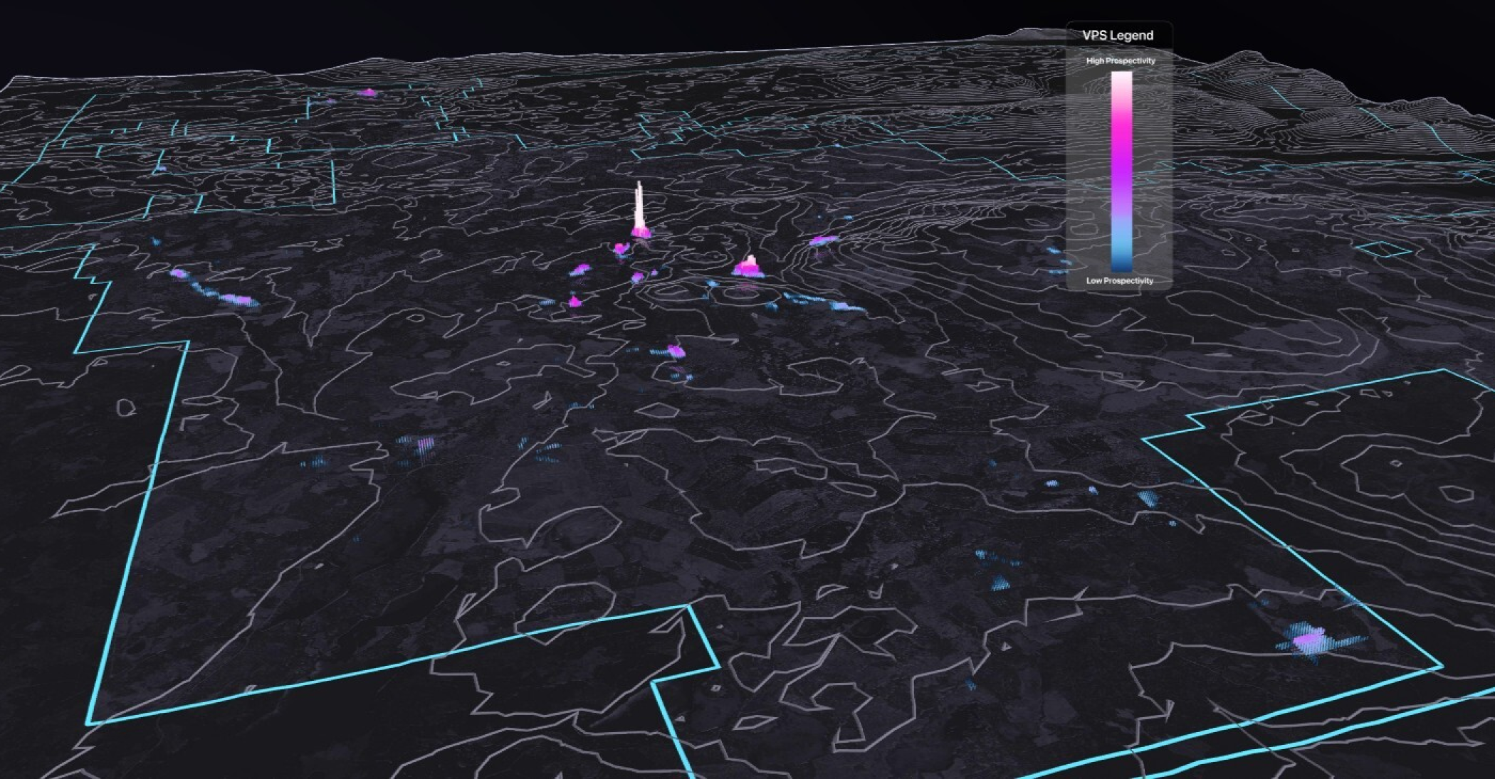
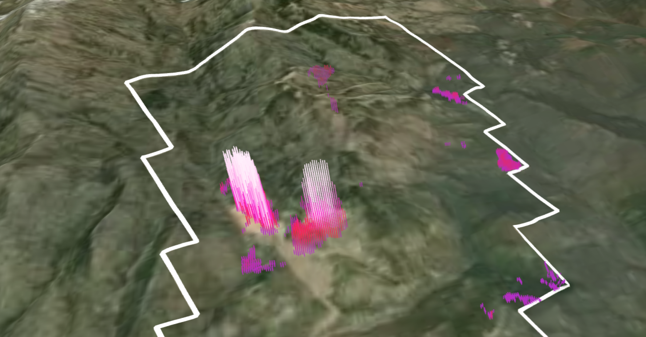
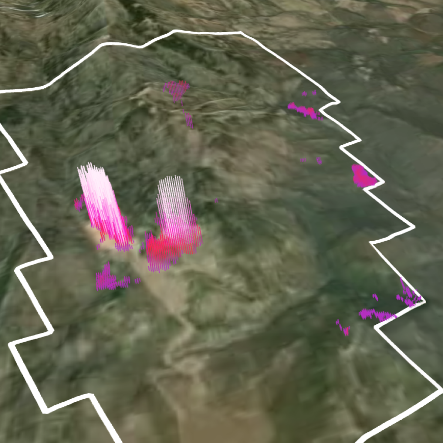
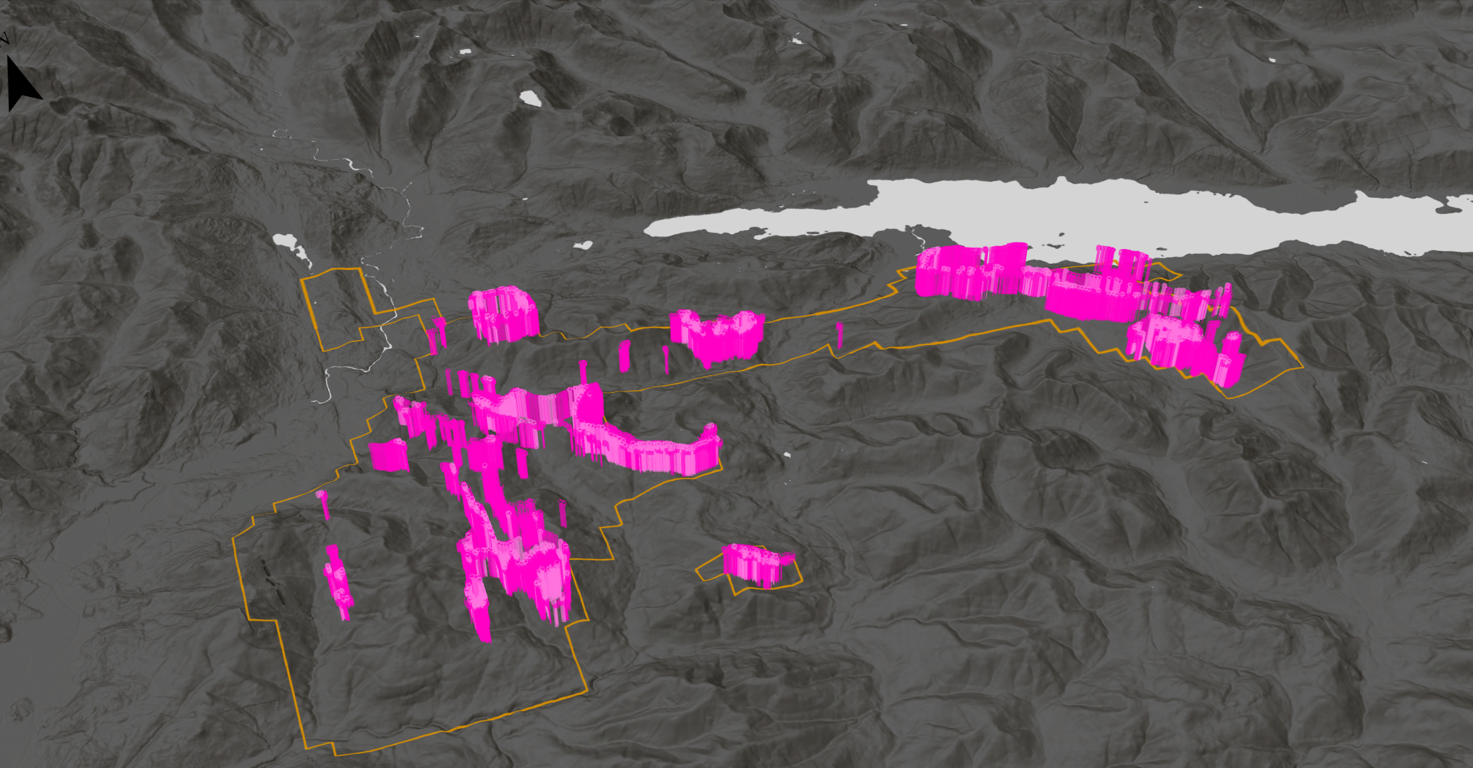
The DORA analysis identified prospective areas with response patterns similar to those associated with known deposits at Woodjam. Several new targets in the southern part of the property show a spatial relationship with favourable northeast-trending lineaments and elevated magnetic susceptibility from regional inversion data.
Overall, the modelling delivered a consistent, property-wide view of prospectivity and provided a clear framework for follow-up planning and ground validation.
"At our Woodjam project, younger cover and uneven data coverage have limited the effectiveness of traditional surface-based exploration methods. VRIFY’s DORA software provided a solution by enabling our team to integrate multiple geophysical and geochemical datasets and systematically evaluate structural trends across the property, helping to inform follow-up planning in underexplored areas."
Steve Blower, VP Exploration, Vizsla Copper
<hr />
To learn more about DORA and VRIFY’s broader suite of tools for exploration analysis and effective communication with stakeholders, book a demo with our Geoscience Team.


.jpg)

.png)